
Table of Contents
Introduction
As we know, the earth is not spherical rather elliptical. It is slightly flattened at the poles and bulge in the middle. Similarly, the globe is a true miniature of the earth. It becomes very difficult to locate a place on the sphere like the earth. So, the question arises, how to find or locate a place on the earth. The answer to this question is simple. To find a place we need certain references. The longitude and latitude in map or globe help us to locate a place precisely on the map. Therefore, the longitude and latitude are the references for us to locate a place.
Longitude and latitude on a globe

Important references on the map and globe
Axis
The axis is an imaginary line around which the earth rotates. It passes through the north and the south poles.

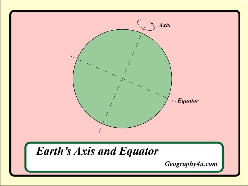
Equator
It is an imaginary line which divides the earth into two halves. Therefore, it is a very important reference point to locate a place on earth.
Latitude (Akshansh)
Latitudes are the parallel circles from the equator up to the north and south pole. Generally, latitudes are measured in degrees. The zero-degree latitude represents the equator. On the other hand, 90⁰N and 90⁰S represent the north and the south poles respectively.

North latitude and South latitude
All the parallels north of the equator are called north latitudes. All the parallels south of the equator are known as south latitudes. Therefore, the value of each latitude is followed by the word North (N) and South (S). For example, both Afghanistan in Asia and Eyre peninsula of South Australia are located on 34⁰ latitude. But the former is 34⁰N of the equator and the latter is 34⁰S of it. So, we can say, Afghanistan is situated at 34⁰N and Eyre peninsula is situated at 34⁰S latitude.
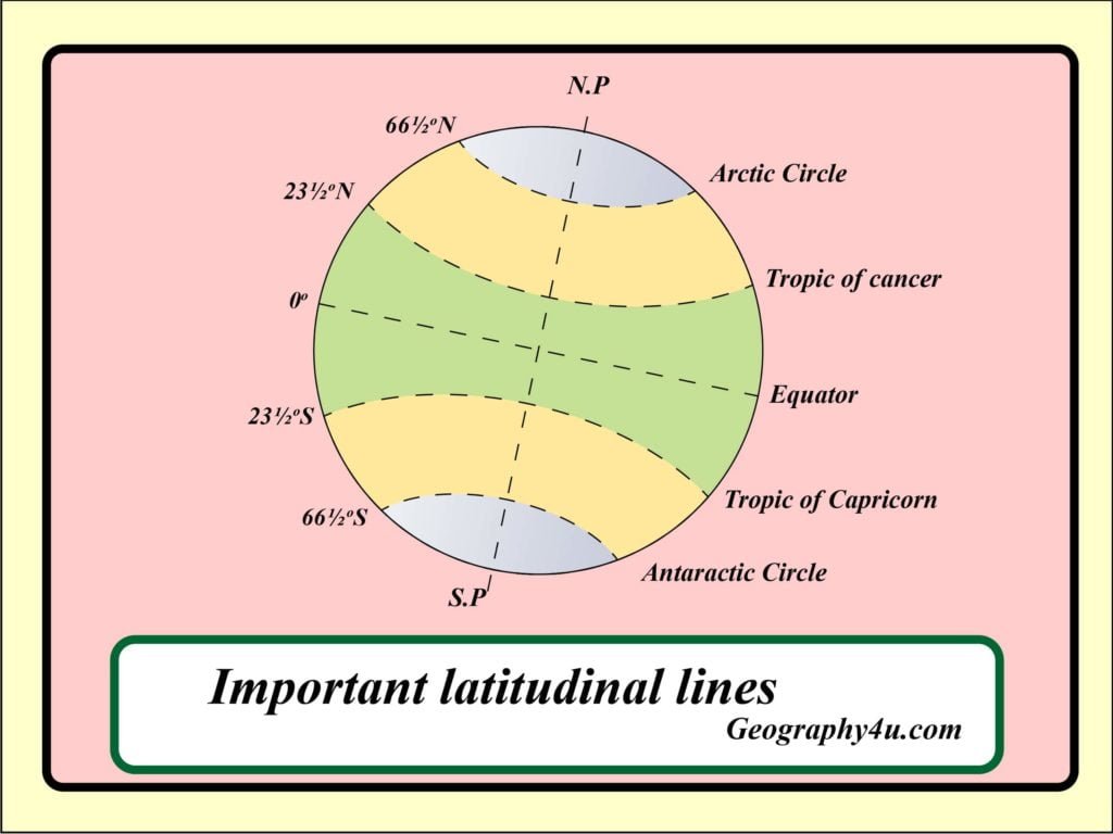
Important parallels of latitudes
- Tropic of Cancer (23½⁰ N) in the Northern Hemisphere.
- Tropic of Capricorn (23½⁰ S) in the Southern hemisphere.
- Arctic Circle (66½⁰ N) North of the equator.
- Antarctic Circle (66½⁰ S) South of the equator.
Heat or temperature zones of Earth


Torrid Zone (Ushna Katibandh)
The area between the tropic of cancer and the tropic of Capricorn receives the maximum sunlight is known as Torrid Zone. Also, there are two torrid zones on earth. For example, the north torrid zone and the south torrid zone.
Temperate zone (Samsitoshna)
The zones which receive moderate sunlight is called temperate zone. It is further divided into Northern temperate zone and Southern temperate zone.
Northern temperate zone
The area between the tropic of cancer and arctic circle represents the Northern temperate zone.
Southern temperate zone
The area between the tropic of Capricorn and the Antarctic circle represents the Southern temperate zone.
Frigid zone (Sheet Katibandh)
The area which is devoid of sunlight or receive little amount of sunlight is known as Frigid Zone. There are two frigid zone on earth which are commonly known as Northern Frigid zone and Southern Frigid zone.
Longitudes (Rekhansh)
Longitudes or meridians of longitudes are the angular distances, measured in degree along the equator east or west of the prime meridian. Also, longitude helps us to find how far east or west a place is from given line of reference running from the North and South pole.
The distance between the meridians is measured in degree of longitude. In addition, each degree is further divided into minutes and seconds. These meridians are semi-circle. However, the distance between them decreases steadily towards the pole. They become zero at the poles, and they all meet at the poles.
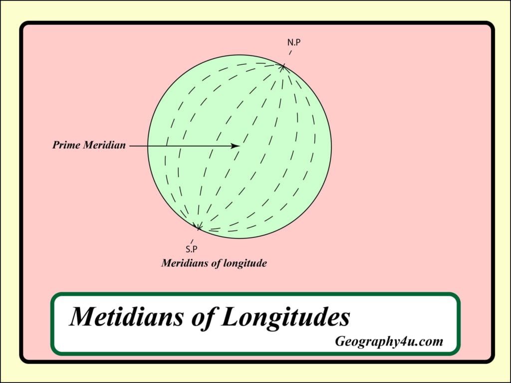
Prime Meridian
The zero-degree longitude which passes through the Greenwich is called Prime Meridian. The 180⁰ and 0⁰ longitude divide the earth into two halves, the Eastern and Western hemisphere. It is very interesting for us that 180⁰E and 180⁰W are on the same line.
How to read longitude and latitude in map
If we know the latitudes and longitudes of a place, we can easily locate a position on the map. To make it easy, take a grid. Mark the vertical lines as 1, 2, 3 and 4. Similarly, mark the horizontal lines as A, B, C and D. The vertical lines represent the longitudinal extent of a place. Similarly, the horizontal lines represent the Latitudinal extent of a place. The intersection of longitudinal and latitudinal lines represents the location of a place. For instance, P⁰N latitude and 1⁰ E longitude. Similarly, we can also locate the position of R, S, S1, T and T1.

Longitude and time zone
The movement of earth, the moon and the planets are the best means of measuring time. The sun is the best time-keeper throughout the world.
When the Greenwich meridian has the sun at the highest point in the sky, the all places along that meridian will have mid-day. Mainly the earth rotates 360⁰ in 24 hours, which is equivalent to 15⁰ an hour or 1⁰ in 4 minutes. For instance, when it is 12 noon at Greenwich, the time at 30⁰ east of Greenwich will be 30×4 = 120 minutes, i.e. 2 hours ahead of Greenwich, which means 2pm. On the other hand, 30⁰ W of Greenwich, the time will be behind Greenwich time by 2 hours, it will be 10am.
Difference between Local time and Standard time
Local time
The time shown by a watch which is adjusted to read 12 O’ clock when the sun is at the highest point (i.e. mid-day) is known as local time.
Standard time
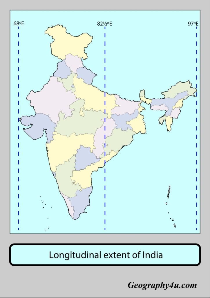
The local time at different longitudes are bound to differ. So, it becomes necessary to have a common time for a region. Therefore, all the countries have their own standard time. Some countries have only one standard time while others have more than one. For instance, 82⁰30 E is the only standard time in India. On the other hand, Russia has eleven time zones. The 82⁰30 E is known as Indian Standard time (IST). The IST is five hours and thirty minutes ahead of Greenwich time.

Download free ppt of Longitude and latitude at this link- geography4u/longitude and latitude
- Plate Tectonics Explained: How Earth’s Moving Crust Built Our World
- Hurricanes, Typhoons, and Cyclones: What’s the Difference and Why 2026 Is Unusual
- What Is a Monsoon? How Earth’s Largest Weather System Works
- Aurora Borealis 2026: The Science, The Solar Maximum, and Where to See the Northern Lights This Year
- How did the theory of plate tectonics evolve over time?
Thank you soo much for this. I have been searching for WAY longer than I’d like to admit to find out whether longitude affects climate and weather, or if it was just latitude. This doesn’t speak directly on it, but it is the first thing I read that makes it clear enough (for me at least) to see what the difference between the two are.
Dear Audrey, thanks for your valuable feedback. if you really liked my work, kindly read and share more articles at geography4u.com