Table of Contents
Himalayas
The Himalayas are one of the most complex mountain systems of the world. It forms a barrier between the Tibetan plateau and the Indian subcontinent. The mountain Himalaya includes the highest mountain peaks in the world. The ranges of the Himalayas are separated by deep valleys. Thus they create a highly dissected topography.

Meaning of Himalaya
In Indian culture Hima means Snow, and the Alayas means the adobe. Thus called The Himalaya.
Origin of Himalaya mountain system
The scholars have put forth various views regarding the origin of the Himalayas. Based on these views, the following are the categories of Himalayan formation.
- Geosynclinal evolution
- The plate tectonic origin of Himalayas
Geosynclinal evolution
Leopold Kober, Suess and Émile Argand are the main exponents of this theory. According to these scholars, the disintegration of Pangea led to the formation of the Tethys Sea between Angaraland and Gondwana land in the north and south respectively. Consequently, the Tethys sea occupied the region of Himalayas during the Mesozoic era. The eroded sediments derived from these two landmasses were deposited in the Tethys sea.
During the cretaceous period, the bed of the sea started rising due to convergent movement of the adjoining landmasses. This upliftment led to the folding of the sediments in the three successive ranges of the Himalayas.
| Sr. No. | Events | Results |
| 1. | First upheaval during the Eocene period | Formation of Greater Himalayas |
| 2. | Second upheaval during the Miocene period | Formation of Lesser Himalayas |
| 3. | Third upheaval during the Pliocene period | Formation of Shiwalik |
The plate tectonic origin of Himalaya
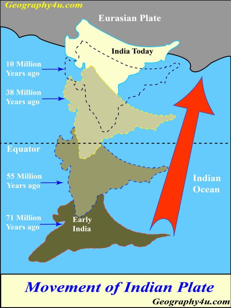
According to the plate tectonic theory, the fold mountains like the Himalayas are formed at the converging boundaries of the plates. Similarly, the rise of the Himalayas was the outcome of the collision between the Indian Plate and the Eurasian plate.
It has been highlighted that about 70 million years ago there was an extensive Geosyncline in the place of Himalaya. This geosyncline was known as Tethys sea. The sea began to contract due to the converging movement of the two plates. Meanwhile, the sediments of the Tethys sea were squeezed and folded into three parallel ranges of the Himalayas.
Structure of the Himalayan system
Structurally, Himalaya may be classified under Alpine and Sub-Alpine type of fold mountain.
- In the western mountains of Himalaya (Spiti region), the structure is of Sub-Alpine type.
- While, Shimla, Garhwal and Kumaun have Alpine structure.
- The existence of Syntaxial bends is one of the interesting features of the Himalayas.

Structural zones of Himalayas
- Indo-Tsangpo suture zone (ITSZ)- Tibetan Himalaya and Greater Himalaya.
- Main central thrust (MCT)- Lesser Himalaya or Midder Himalaya or Himachal.
- Main boundary thrust (MBT)- Shiwalik or the outer Himalaya.
- Himalayan front fault (HFF)
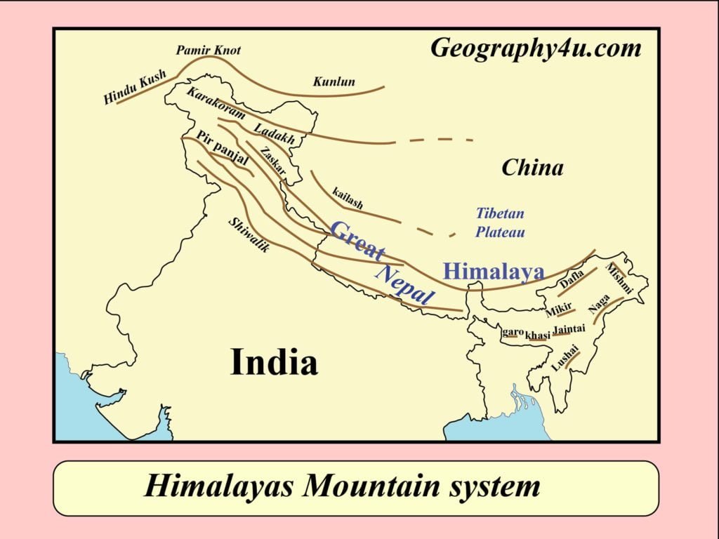
Himalayan ranges
- Shiwalik range.
- Lesser or middle Himalayas or Himachal.
- Greater Himalayas.
- Trans Himalaya


Manali region 
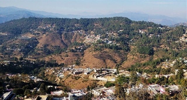
Almora 
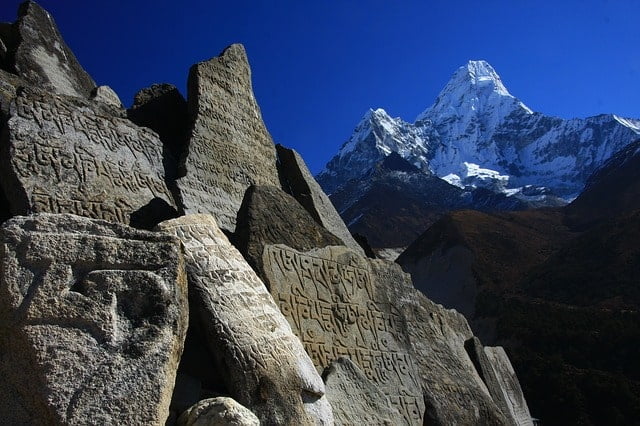
Himalayas in Nepal 
Buddhist monasteries 
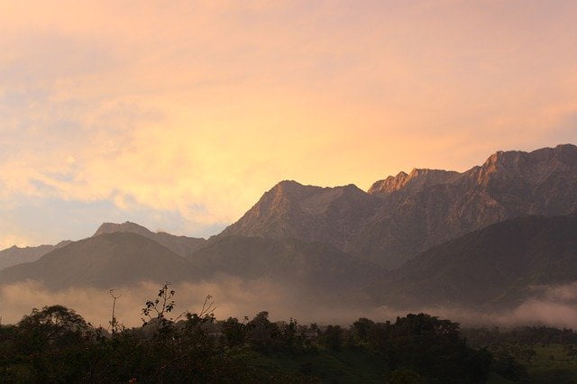
Dhauladhar 
Spiti 
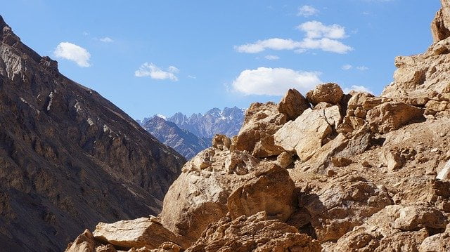
Ladakh- Markha valley
Shiwalik range
- Shiwalik is the southernmost and youngest Himalayan range.
- Shiwaliks were formed in the Tertiary period (2-20 million years ago)
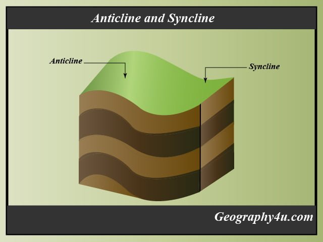
- It has a series of anticlines and synclines.
- It is also known as Outer Himalayas.
- The average elevation of Shivalik is between 600m to 1500m.
- The western and eastern extent of Shivalik is about 2400km, runs between Potwar plateau and Brahmaputra valley in west and east respectively.
- This range runs parallel to the middle Himalayas.
- It is broader in the west but narrower in the east.
- Because of the descending rivers in the north, the Shiwaliks are not continuous.
- The formation of Duars and Doons in the east and west direction respectively is one of the most interesting features of the Shiwalik.
- The accumulation of conglomerates mainly sand and silt formed the Shiwaliks.
- It is covered with thick forest in Northern-east Indian region to Nepal region.
- In the regions of Punjab and Himachal, Shiwalik is almost devoid of forests.
| Sr No. | Local names of Shiwalik | Regions |
| 1. | Dafla, Miri, Abhor Mishmi hills | Arunachal Pradesh |
| 2. | Churia hills | Eastern Nepal |
| 3. | Dhang and Dundhwa | Western Nepal |
| 4. | Jammu hills | Jammu region |
Important duns or doons of Shiwalik
- Chandigarh-Kalka dun.
- Nalagarh dun.
- Dehra dun.
- Harike dun.
- Kota dun.
Dehradun is the largest dun of all the duns, having a length and width of 35-45 km and 22-25 km respectively.
Middle or Outer Himalayas
- Middle Himalaya runs parallel to the Great Himalaya, having an average elevation of 3500- 4500m.
- It is also known as Himachal or Lesser Himalaya.
- The middle Himalayas are marked by thrust sheets and Nappe formation.
- It mainly composed of unfossiliferous Precambrian, Paleozoic and Mesozoic formation.
- Important rocks of Lesser Himalayan regions are slate, limestone and quartzite.
- The peaks in this region are mostly covered by snow throughout the year.
- The bare southern slope and forest cover in the northern region gives it a Hogback look.
Important Middle Himalayan ranges
- Pirpanjal. (Kashmir)
- Dhouladhar. (Himachal Pradesh)
- Mussoorie range. (Uttrakhand)
- Nagtiba range. (Uttrakhand)
- Mahabharat range. (Nepal)
Passes of the Middle Himalaya
- Pir Panjal Pass.
- Budil Pass.
- Banihal Pass.
- Rohtang Pass

The Greater Himalaya
- It is the northernmost range of the Himalayan region.
- This is the most continuous and loftiest range of the Himalaya.
- The average height of the greater Himalaya is about 6100m.
- It is also known as Inner Himalaya or Himadari.
- The greater Himalaya has the largest peak in the world, Mount Everest.
- The height of the Mount Everest is about 8848m-8850m.
- The mountains are convex to the south, terminates abruptly in the Nanga Parbat in the north-west and the Namcha Barwa in the north-east.
- It mainly composed of Granite, Gneisses and Schists.
Regional name of Mount everest
- Sagarmatha (Nepali).
- Chomolungma (Tibetan)
- Qomolangma Feng (Chinese)
The Great Himalayan Passes
| Sr. No. | Passes of greater Himalaya | Region |
| 1. | Burzil pass, Zojila pass | Jammu and Kashmir |
| 2. | Thalga, Niti, Mana, Dungri la and Lipu Lekh | Uttrakhand |
| 3. | Bara-la-cha-la, Shipki-la | Himachal Pradesh |
| 4. | Nathula and Jelapla | Sikkim |
Trans or Tibetan Himalaya
- Trans Himalayan region lies in the north of Greater Himalaya.
- As these mountains lie mostly in the Tibetan region, hence called Tibetan Himalaya.
- The average elevation of Trans Himalaya is about 3000m above the mean sea level.
Important ranges of Trans Himalaya
- Zanskar.
- Ladakh.
- Kailash.
- The Karakoram.

Some highest peaks of Himalayas

Important plants of Himalayas
- Ironwood.
- Oaks.
- Chestnuts.
- Bamboos.
- Alder.
- Pines.
- Palms, etc.

Ironwood 
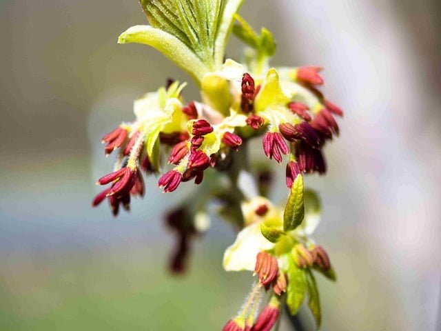
Alder plant 
Cedar trees 
Chestnuts 
Juniper 
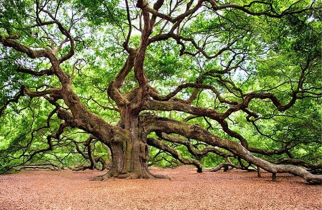
Oak tree 
Pine trees
Important Himalayan animals
- Yak.
- Langur.
- Kashmiri Stag.
- Clouded leopard.
- Bears.
- Panda.
- Antelope.
- Donkey.
- Wild goats.
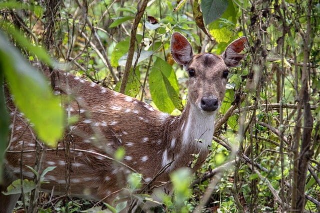
- Deer, etc.

Himalayan Yak 
Langur 
Musk dear 
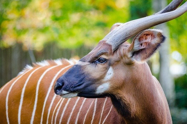
Himalayan Antelope 
Clouded leopards 
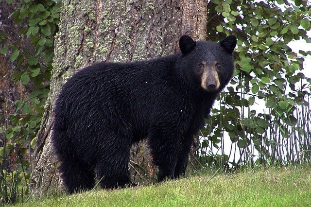
Black bear 
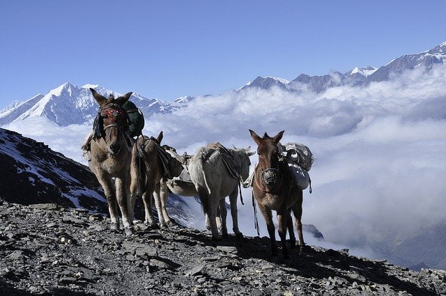
Himalayan donkeys 
Red panda 
Himalayan stag 
Yak 
Pheasant 
Wild Bird

Download the PPT of Mountain Himalayas at Slideshare- mountain of Himalaya











This post on the Himalayas is fascinating! The maps really help visualize the different ranges and their significance. I appreciated the detailed descriptions of each range, especially the information about Annapurna and K2. It’s amazing how much biodiversity and culture exists in these mountains. Thanks for sharing such valuable geography facts!
What an informative post! I loved the detailed maps and diagrams you included – they really helped visualize the important ranges of the Himalayas. It’s fascinating to learn about the geography and significance of this majestic mountain range. Thanks for sharing such valuable insights!
This post beautifully highlights the majestic Himalayas and their significance. The maps provided are incredibly helpful for visualizing the various ranges. I especially appreciated the detailed descriptions of each range and their geological features. Can’t wait to explore more geography facts on your site!